Food: Meals while on trek & at Hotel/Guesthouse (Veg)
Location: Uttarakhand
Distance: 79 Km.
Trail Type: Summit, Point to point | Scale a peak, Camping at the same location upon returning.
AirPort: Jolly Grant Airport, which is 28 km away from Dehradun
Highlights:
USD 5300 for Non-Indians and OCI card holders
Services from Gangotri to Gangotri.
Base Camp Accommodation: Home stay with attached washroom (no bunk beds).
Complimentary cloakroom at base camp for safe storage.
Pickup & Drop Location: Nearest Railway Station Pickup: 06:00 AM | Drop: 06:30 PM–07:30 PM (weather/road dependent) Keep a buffer day and arrive a day early to avoid delays.
Who Can Participate
Age Requirements:
Minimum 18 years
For Indian citizens: A basic mountaineering course is required.
For non-Indian citizens: Must have successfully climbed at least one peak over 6,000m.
Fitness Criteria:
The trekker should have sufficient stamina to cover 7 km of distance by jogging in 35 minutes without stress or 12 km of distance in 60 minutes without stress
If the trekker prefers cycling he/she should be able to cycle 35 km of distance in 90 minutes.
Trekkers must be able to carry a 10-15 kg backpack, as off-load options are not recommended.
If a trekker’s BMI is more or less than the normal range (18-25), please consult our Trek Coordinator before booking.
Itinerary
Day-1: Arrival in Gangotri
Altitude Gangotri: 3,100 m / 10,200 ft
Drive Distance: 250 km (8–9 hrs)
Day-2: Rest & Acclimatization Day at Gangotri
Altitude Gangotri: 3,100 m / 10,200 ft
Post lunch you can visit Gangotri Temple or go shopping.
Day-3: Gangotri to Bhojwasa
Altitude:
Gangotri: 3,100 m / 10,200 ft
Bhojwasa: 3,800 m / 12,500 ft
Trek Distance: 14 km | 7 hrs
Day-4: Bhojwasa to Nandanvan
Altitude:
Bhojwasa: 3,800 m / 12,500 ft
Nandanvan: 4,500 m / 15,000 ft
Trek Distance: 8 to 9 km | 5–6 hrs
Day-5: Nandanvan to Vasuki Tal (Base Camp)
Altitude:
Nandanvan: 4,500 m / 15,000 ft
Vasuki Tal (Base Camp): 5,000 m / 16,400 ft
Trek Distance: 7 km | 4–5 hrs
Day- 6 to 7: Day 6 & day 7 Rest & Acclimatization Day at Base Camp
Check equipment and basic snow & ice craft training
Rest day is highly advisable for better acclimatization
Day- 8 to 19: Day 8 to Day 19: Base Camp to Satopanth Peak summit and back to Base camp
As weather in the mountains is highly unpredictable, we maintain a flexible schedule to adapt to changing conditions and ensure safety. These days account for load ferries between the camps, acclimatization, and buffer time for bad weather.
Advance Base Camp: Altitude (5,140 m / 16,900 ft)
Camp 1: Altitude (5,750 m / 18,900 ft)
Camp 2: Altitude (6,200 m / 20,300 ft)
Mt. Satopanth Summit: Altitude (7,075 m / 23,210 ft)
Day- 20: Vasuki Tal Base camp to Bhojwasa
Altitude:
Vasuki Tal (Base Camp): 5,000 m / 16,400 ft
Bhojwasa: 3,800 m / 12,500 ft
Distance: 19 km | 7–8 hrs
Day- 21: Bhojwasa to Gangotri
Altitude:
Bhojwasa: 3,800 m / 12,500 ft
Gangotri: 3,100 m / 10,200 ft
Trek Distance: 14 km | 6–7 hrs
Day- 22: Gangotri to Dehradun
Drive Distance: 250 km (9–10 hrs)
Arrival in Gangotri
Altitude Gangotri: 3,100 m / 10,200 ft
Drive Distance: 250 km (8–9 hrs)
Your journey begins in Dehradun, where you will embark on a scenic drive through the picturesque landscapes of Uttarakhand. The first stop on your route is Mussoorie, a renowned hill station known for its serene beauty and pleasant weather. It is often referred to as the "Queen of Hills," is a popular tourist destination offering stunning views of the Himalayas, colonial-era architecture, and a tranquil atmosphere. After Mussoorie, you continue your journey toward Uttarkashi, a town famous for its spiritual significance. Often called the "Kashi of the North," Uttarkashi is home to the revered Kashi Vishwanath Temple, dedicated to Lord Shiva, and attracts many pilgrims seeking blessings.
From Uttarkashi, your drive takes you through the enchanting Harshil Valley, a hidden gem nestled along the Bhagirathi River. The valley is known for its lush greenery, crystal-clear waters, and majestic views of snow-capped peaks, offering a refreshing contrast to the more bustling towns. Finally, after a scenic drive through Harshil, you will reach your destination: Gangotri.
Gangotri is one of the four sacred Char Dham pilgrimage sites and is considered the source of the Ganges River. Surrounded by rugged terrain and towering mountains, Gangotri offers a spiritual atmosphere, and the sight of the holy river flowing from the glaciers is truly awe-inspiring.
Rest & Acclimatization Day at Gangotri
Altitude (Gangotri): 3,100 m / 10,200 ft
Post lunch you can visit Gangotri Temple or go shopping.
Day 2 in Gangotri is planned as a rest and acclimatization day, allowing you to adjust to the higher altitude before continuing your journey. Start your day with a visit to Bhagirath Shila, a significant religious site where it is believed that King Bhagirath meditated in order to bring the holy Ganges River to Earth. This sacred rock is a peaceful place where many pilgrims come to offer their prayers, and it provides a serene environment for reflection. From Bhagirath Shila, take a short walk to Surya Kund. It is an ideal spot to relax and unwind, while also soaking in the calm, natural surroundings.
Next, head to the Gauri Kund Waterfall, located a short distance from the hot spring. This beautiful waterfall cascades down with great force, creating an impressive spectacle against the backdrop of the towering mountains. The serene ambiance around the waterfall provides the perfect opportunity to pause and connect with nature, with the sound of the rushing water adding to the tranquillity of the environment.
In the afternoon, embark on a light hike to Pandav Gufa, a small cave believed to have been used by the Pandavas during their journey to the Himalayas. According to local legend, the Pandavas, the heroes of the Mahabharata, rested here on their way to the mountains. The hike to the cave is not strenuous and offers an excellent opportunity to enjoy the stunning natural beauty of the region. Along the way, you’ll be treated to breathtaking views of the surrounding valleys and snow-capped peaks.
The rest of the day can be spent relaxing in Gangotri, taking in the peaceful atmosphere of this sacred place. By the end of Day 2, you should be well-acclimatized to the altitude, making you ready for the next phase of your spiritual and physical journey.
Gangotri to Bhojwasa
Altitude:
Gangotri: 3,100 m / 10,200 ft
Bhojwasa: 3,800 m / 12,500 ft
Trek Distance: 14 km | 7 hrs
Accommodation: Guest House
On Day 3, after a hearty breakfast, the trek from Gangotri towards Bhojwasa begins. The journey starts with a pleasant walk before reaching the check post, where permits are verified. The trail then begins to gradually ascend, with the soothing sound of the Bhagirathi River flowing besides, providing a calm backdrop. As the walk continues, Mt. Sudarshan emerges in the distance, adding to the beauty of the landscape.
After covering a few kilometers, you will come across a boulder zone where the path becomes slightly challenging, but the effort is rewarded with a few small tea stalls where trekkers can take a brief rest and refuel with a warm drink. Continuing onward, you arrive at Chirbasa, a serene spot named after the chir trees that blanket the area, creating a peaceful atmosphere.
As the trail progresses, the valley gradually opens up, revealing majestic snow-capped peaks that dominate the horizon. Among these peaks, the stunning Bhagirathi Peak comes into view, standing tall and proud. The sight is truly awe-inspiring while trekking through this serene landscape.
Before reaching Bhojwasa, you pass through a few landslide-prone areas that require extra caution and careful navigation. These sections demand full attention during the journey. However, once Bhojwasa is reached, the effort is well worth it. Bhojwasa is an open campsite surrounded by magnificent views, where the towering Mt. Shivling can be seen in the distance. The Bhagirathi River flows gently beside the camp, creating a tranquil setting perfect for a night of rest and reflection after a day of trekking through such awe-inspiring terrain.
Bhojwasa to Nandanvan
Altitude:
Bhojwasa: 3,800 m / 12,500 ft
Nandanvan: 4,500 m / 15,000 ft
Trek Distance: 8 to 9 km | 5–6 hrs
Accommodation: Tent
Today, to continue the journey beyond Bhojwasa, you have to cross the Bhagirathi River. Trekkers and locals alike rely on an age-old, manually operated trolley system to make the crossing. This traditional method is both fascinating and functional. A sturdy metal platform or basket is suspended on a cable, which stretches across the river, and it is the responsibility of a team of trekkers or local helpers to pull the trolley from one side to the other. The system operates through a simple yet effective rope-and-pulley mechanism, requiring strength and teamwork to navigate the fast-moving waters below.
The terrain beyond the crossing is rocky, and the path becomes more challenging as it winds through boulder sections that demand careful footing. Every step requires attention, as the trail often shifts between solid ground and loose rocks, making the journey feel both exhilarating and demanding. However, the beauty of the surroundings more than makes up for the difficulty.
As you continue along the Bhagirathi River, the sound of rushing water accompanies your steps, creating a soothing soundtrack to your journey. The river narrows, and with each twist and turn of the path, the landscape grows more dramatic. Eventually, after covering some distance, Gaumukh comes into view. The sight is nothing short of awe-inspiring. This is where the Bhagirathi River is born, from the mighty ice of the glacier.
From Gaumukh, the path leads into the heart of the Gangotri Glacier itself, a vast expanse of ice and mud that stretches as far as the eye can see. As you traverse this ancient glacier, you feel the raw power and serenity of nature in its most unspoiled form. The icy winds and the crunch of snow underfoot mark each step toward your next destination.
After a demanding trek across the glacier, the Nandanvan Campsite is reached. A peaceful spot nestled in the shadow of towering peaks. Here, the iconic Mt. Shivling stands proudly, its majestic, snow-capped peak a striking sight against the clear blue sky. The view of this sacred mountain is both humbling and breathtaking, a perfect reward after the long journey through challenging terrain. The campsite offers a much-needed rest, with the surrounding peaks and the tranquility of the glacier providing a sense of awe and reflection, marking the completion of another significant leg of the journey.
Nandanvan to Vasuki Tal (Base Camp)
Altitude:
Nandanvan: 4,500 m / 15,000 ft
Vasuki Tal (Base Camp): 5,000 m / 16,400 ft
Trek Distance: 7 km | 4–5 hrs
Accommodation: Tent
Today’s journey is a relatively short one, but it’s no less significant. You begin with a steady, gradual ascent along the Chaturangi Glacier, the frozen expanse leading us toward Vasuki Tal. This will serve as our basecamp for the expedition, a place of both rest and preparation for the difficult days ahead. The path involves a diagonal traverse across the glacier, which requires focus and steady footing. After that, we face a brief but rewarding ascent, followed by an even shorter descent, bringing us to the peaceful shores of Vasuki Tal.
As we stand at the edge of the lake, surrounded by the towering peaks of the mountains, a deep sense of awe and respect settles in. The grandeur of the landscape amplifies the enormity of the task that lies ahead. Reaching the base of the mountain brings a humbling realization: the challenges, the risks, and the rewards of this expedition are all just beginning to unfold. It’s a quiet but powerful moment, a reminder of both the beauty and the difficulty of the journey we’re about to undertake in the coming days.
Day 6 & day 7 Rest & Acclimatization Day at Base Camp
Check equipment and basic snow & ice craft training
Rest day is highly advisable for better acclimatization
Day 8 to Day 19: Base Camp to Satopanth Peak summit and back to Base camp
As weather in the mountains is highly unpredictable, we maintain a flexible schedule to adapt to changing conditions and ensure safety. These days account for load ferries between the camps, acclimatization, and buffer time for bad weather.
Advance Base Camp: Altitude (5,140 m / 16,900 ft)
Camp 1: Altitude (5,750 m / 18,900 ft)
Camp 2: Altitude (6,200 m / 20,300 ft)
Mt. Satopanth Summit: Altitude (7,075 m / 23,210 ft)
As the weather in the mountains can be highly unpredictable, the schedule remains flexible to adapt to changing conditions and ensure safety. These days account for load ferries between the camps, acclimatization, and buffer time for bad weather.
Advance Base Camp: The Advance Base Camp is located at an altitude of 5140 meters, offering a stunning view of the surrounding peaks. As you begin your trek, you’ll follow a narrow ridge, with the massive Chaturangi Glacier stretching out to your left and the majestic Vasuki Parvat towering to your right. The path gradually unfolds, and before long, you'll catch a glimpse of the iconic Mt. Satopanth in the distance, adding to the awe-inspiring scenery.
As you descend, you’ll approach Sundar Bamak, a vast glacier that marks a significant landmark on your journey. From here, you’ll take a right turn and continue walking for several kilometers. The terrain gradually leads you closer to your destination, and after covering this stretch, you’ll finally reach the Advance Base Camp, located at the lateral moraine of Sundar Bamak.
Camp 1: Camp 1 is set up at an elevation of 5,750 metres. The route to Camp 1 begins by heading eastward along the Sundar Bamak. After a short distance, you reach the base of the North-east ridge, which connects to the North face of Satopanth Peak. The ascent along the North-east ridge involves navigating through a mix of unstable rock and scattered ice patches. Camp 1 is established near a solitary Ice Pinnacle, marking the endpoint of this stage.
Camp 2: Reaching camp 2 is the most thrilling part of the climb, as the North-East ridge sharpens after Camp 1. This section, known as the Knife Ridge, stretches for about 1 km and demands technical skills to navigate. With near-vertical drops on both sides, the ridge offers stunning views. On the eastern side, you'll see the Suralaya Bamak Glacier, while to the west lies the Sundar Bamak. After skillfully crossing the ridge with the aid of fixed ropes, you'll reach Camp 2 at an elevation of around 6200 meters.
Mt. Satopanth Summit (7,075 m): The final push to the summit of Mt. Satopanth from Camp 2 is undoubtedly the most exhilarating and demanding part of the entire expedition. The ascent begins around midnight, when the surrounding environment is calm, and the temperatures are lower, making the ice and snow conditions more stable. This timing is critical for safety and for ensuring that the frozen surfaces are solid and secure.
The most technical and challenging part is crossing the boulder and rock patches, which require precise and careful maneuvering. This part of the route is negotiated with the help of fixed ropes, which are placed along the rock faces and boulders for climbers to rely on. This section requires not only physical strength and agility but also mental focus, as the rock and boulder surfaces can be tricky and require precision to navigate. It’s a strenuous and sometimes nerve-wracking part of the journey, demanding full attention and teamwork.
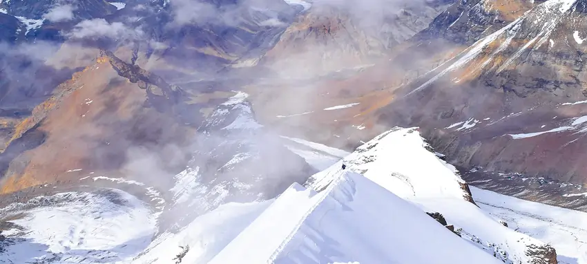
Reaching the summit of Satopanth at 7,075 meters is an incredible achievement, offering a truly rewarding experience. From the top, the expansive views are simply breathtaking. The jagged peaks of the Garhwal Himalayas stretch across the horizon, while the vast Tibetan Plateau unfolds in the distance. The landscape is stark, rugged, and awe-inspiring. This is an unforgettable moment that makes the challenging ascent well worth the effort.
Descend Back to Base Camp (Vasuki Tal): Descending from a mountain can often be more perilous than the ascent, as fatigue sets in and focus tends to wane. It’s crucial to maintain the same level of attention and caution as when climbing. Once the descent is completed safely, take the time to rest and rejuvenate at Base Camp. It’s the perfect opportunity to reflect on the journey, recover from the physical exertion, and prepare for the next phase of the adventure.
Vasuki Tal Base camp to Bhojwasa
Altitude:
Vasuki Tal (Base Camp): 5,000 m / 16,400 ft
Bhojwasa: 3,800 m / 12,500 ft
Distance: 19 km | 7–8 hrs
Accommodation: Tent
After a peaceful and restful sleep, start your day by refreshing yourself. Take a moment to enjoy your morning meal, fueling up for the journey ahead. Once you're ready, pack your bags and prepare for the next leg of the trek. Today, you'll be heading back towards Bhojbasa, passing through the serene and picturesque Nandanvan.
As you set off, the trail will take you through the iconic Gaumukh, a significant spot along the way. Gaumukh, the mouth of the Ganges, holds both spiritual and natural importance, offering a serene atmosphere to reflect on your journey so far. You will be able to spot the majestic Bhagirathi and Shivling peaks, standing tall against the sky. Continuing your trek, you will make your way toward Bhojwasa, a place known for its stunning views and peaceful ambiance.
Along the way, you’ll experience a sense of deep connection with nature, and your heart will fill with gratitude for the stunning landscapes and the opportunity to be surrounded by such natural beauty. The descent might be physically demanding, but each step brings a rewarding sense of accomplishment.
Upon arriving at Bhojwasa, take time to rest and rejuvenate. The peaceful surroundings will offer a perfect setting to reflect on the journey and rest your tired muscles. The tranquil atmosphere of Bhojwasa will provide a sense of serenity, allowing you to fully appreciate the magnificence of the place and the journey you’ve undertaken.
Bhojwasa to Gangotri
Altitude:
Bhojwasa: 3,800 m / 12,500 ft
Gangotri: 3,100 m / 10,200 ft
Trek Distance: 14 km | 6–7 hrs
Accommodation: Guest House
Today, the trek takes you from Bhojwasa back to Gangotri, signaling the end of a remarkable trek journey. The morning begins with a quiet sense of reflection, knowing that this is the last stretch of your path through the mountains.
Following the Bhagirathi River downstream, you walk the familiar trail through the whispering Chirbasa pine forests. The scenery gradually softens, shifting from the raw, high-altitude wilderness to the gentler charm of the lower valley. As you descend, you move through landscapes that have become part of your story. Sparkling waterfalls, cool streams, and the rugged cliffs that now feel like old companions. Stay mindful of the rocky sections, but also take time to enjoy the journey, letting your surroundings sink in one last time.
With every step, you bid farewell to the towering peaks that have silently accompanied you. Their presence fades from sight, but not from memory. A quiet pride begins to rise, the kind that comes from pushing boundaries, from walking in the heart of the Himalayas.
As Gangotri reappears on the horizon, that pride deepens. You’ve completed a trek rich in beauty and spirit. Back in the rhythm of town life, you might visit the temple for a final moment of gratitude or simply embrace the warmth, comfort, and rest awaiting you. A hearty meal and a peaceful night at a cozy guesthouse await.
After your meal, as you begin packing for the journey to Dehradun and, eventually, home, you carry with you more than just your belongings. You carry the stillness of mountain mornings, the clarity of glacial air, and the quiet strength found on a trail walked with purpose.
Gangotri to Dehradun
Drive Distance: 250 km (9–10 hrs)
Your final day begins with the soothing comfort of morning tea in the sacred town of Gangotri. As the light spills over the mountains, take a quiet moment to bid farewell to the towering peaks that have stood watch over your unforgettable journey.
Before setting out, gather for one last group photo, a snapshot of the friendships forged and memories created amidst the serenity of the Himalayas. This simple gesture captures the spirit of camaraderie that has grown stronger with every step of the trek.
The return journey retraces your path through the awe-inspiring landscapes of Uttarakhand. The Bhagirathi River flows alongside, its gentle murmurs echoing the rhythm of your adventure. As you pass through the picturesque towns of Uttarkashi and Mussoorie, the road winds through ever-changing scenery from lush forests, cascading hills, to sweeping mountain vistas that remind you of the path you’ve conquered.
By late afternoon, you'll arrive in Dehradun. The circle completes, and with hearts full and spirits lifted, you part ways, carrying with you the stories, connections, and quiet strength found on the trail to Gaumukh Tapovan.
Trek Essentials
Backpack with rain cover
(60 – 70 ltr) with comfortable shoulder straps
Day pack with rain cover
20 – 30 ltr
Walking stick
Advisable (At least one)
Water Bottle / Hydration pack
2 bottles of one liter each, People who use hydration pack 1 hydration pack and 1 bottle of one liter, Carry at least one thermos flask.
Small size tiffin/lunch box
1 Nos
Snacks
Energy bars, dry fruits, electral/ors
Personal Medical Kit
Consult your doctor
T-Shirt (Synthetic quick dry)
2 Full & 2 Half sleeves
Fleece T-shirt
2 Nos.
Fleece jacket
1 Nos
Windproof Jacket
1 Nos.
Down feather / Hollow jacket
1 Nos.
Thermal inner (Upper and Lower)
1 Pair
Trek Pant (Synthetic quick dry)
3 Nos.
Fleece Pant
1 Nos.
Waterproof gloves
1 Pair
Fleece / woollen gloves
1 Pair
Poncho / waterproof Jacket and pant
1 Nos.
Head torch
1 Nos. (Avoid Hand torch)
Sun Cap
1 Nos
Woolen cap
1 Nos.
Balaclava
1 Nos.
Buff / Neck-gaiters
1 Synthetic & 1 Woollen
Sunglasses
UV with dark side cover, People who wear spectacles – (A)- Use contact lenses | (B)- Photo chromatic glasses
Trekking shoes
1 Pair (Water-resistant, high ankle, good grip)
Floaters / flip-flops
1 Pair
Cotton socks
10 pairs
Woollen socks
3 pairs
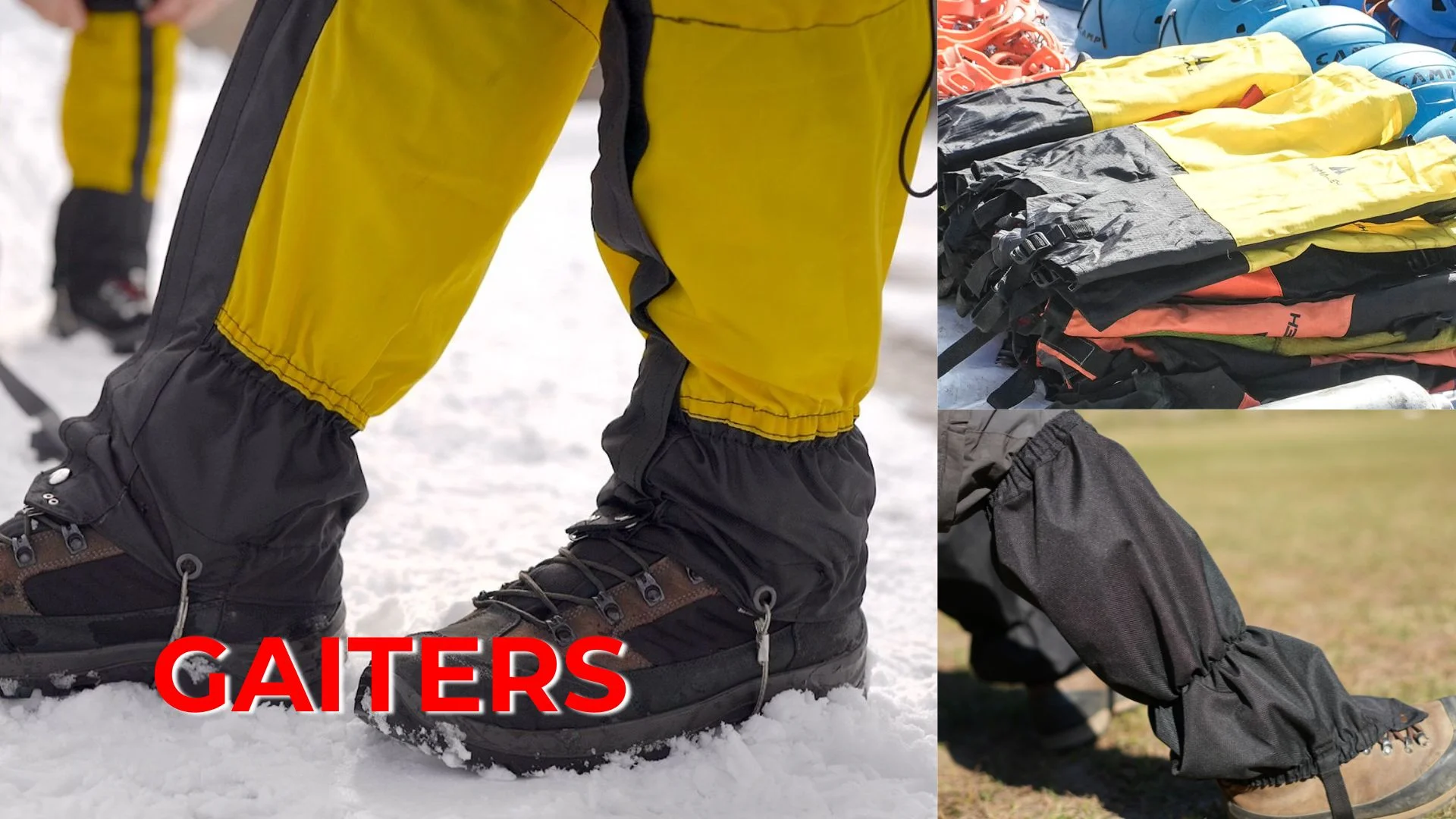
Gaiters
1 Pair (TTH provides when required)
Micro spikes
1 Pair (TTH provides when required)
Sunscreen
1 Nos
Moisturiser
1 Nos
Chap-stick / Lip balm
1 Nos
Toothbrush and toothpaste
1 Nos
Toilet paper & Wipes
1 Nos
Soap / hand sanitizers
1 Nos
Antibacterial powder
1 Nos
Quick dry towel
1 Nos
FAQs
The Satopanth Peak Expedition is a challenging mountaineering expedition in the Garhwal Himalayas of Uttarakhand. The peak stands at an altitude of 7,075 meters. The climb involves glacier travel, crevasse crossings, and technical sections that require mountaineering skills. It is considered one of the most demanding and rewarding high-altitude expeditions in India.
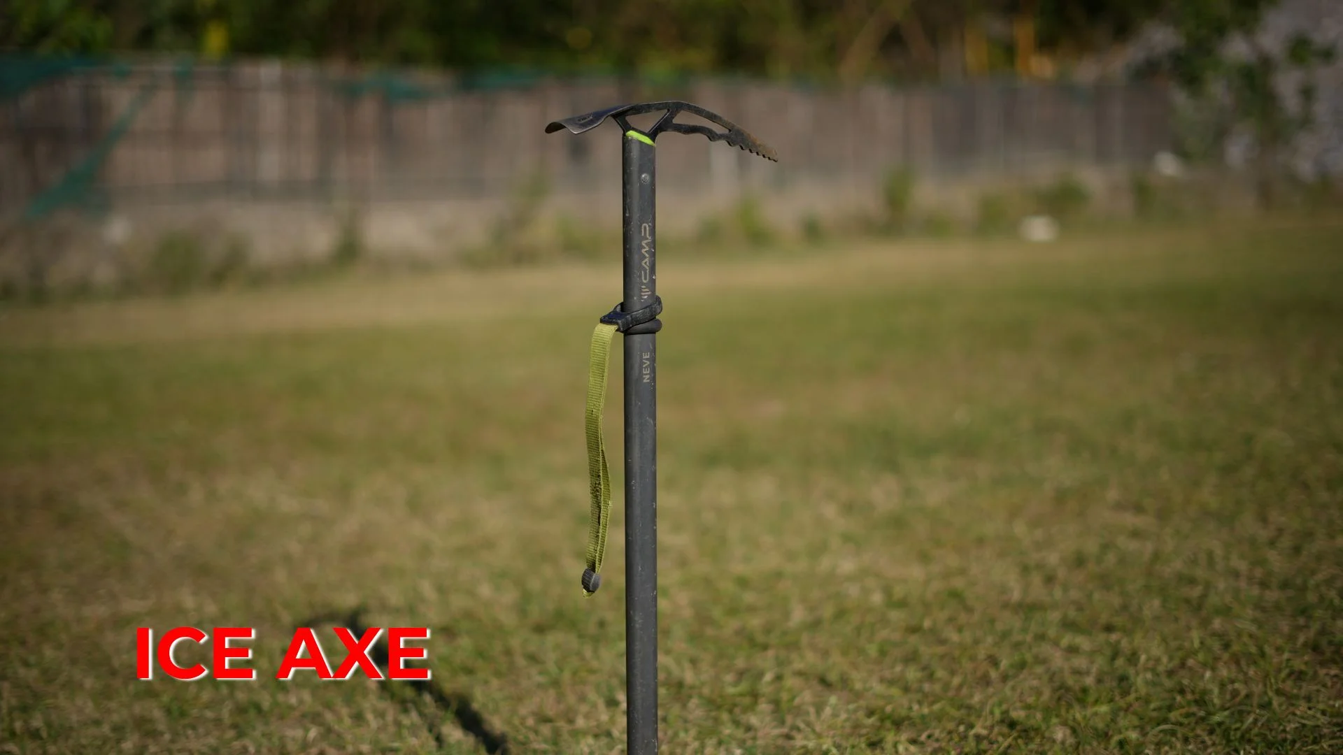
The expedition is considered highly challenging and is suitable for experienced mountaineers. Climbers must deal with steep ascents, glacier travel, technical sections, and extreme altitude conditions. Knowledge of using crampons, ropes, and ice axes is essential.
The best time for the expedition is during the pre-monsoon months (May–June) and the post-monsoon months (September–October). These seasons offer relatively stable weather and safer climbing conditions.
Cardio training: Running, cycling, and swimming to improve endurance.
Strength training: Exercises like squats, lunges, planks, and push-ups.
High-altitude preparation: Trekking at higher altitudes to adapt to low oxygen.
Climbing practice: Learning to use crampons, ropes, and ice axes.
Clothing: Thermal layers, fleece jackets, and waterproof outer layers.
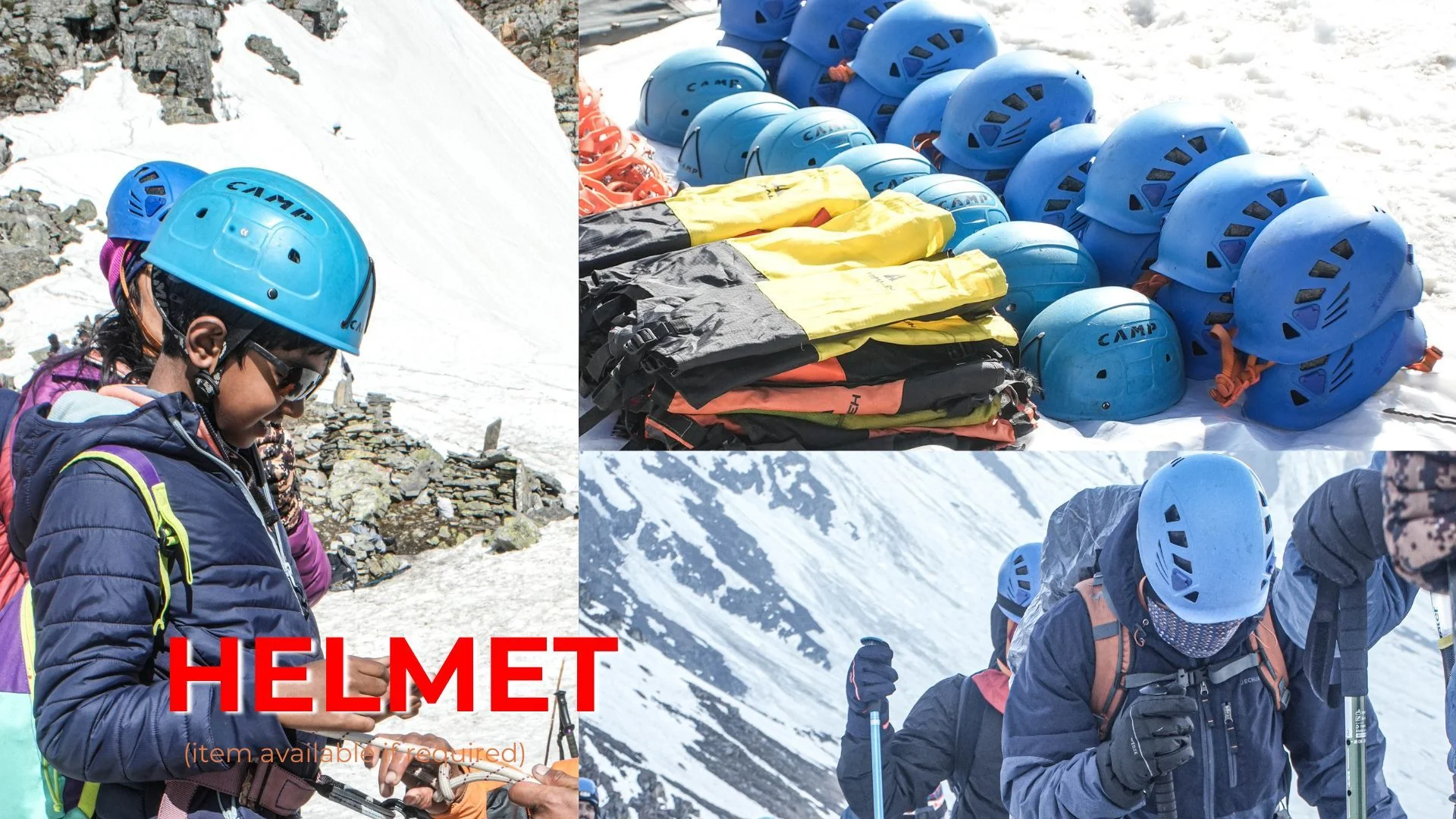
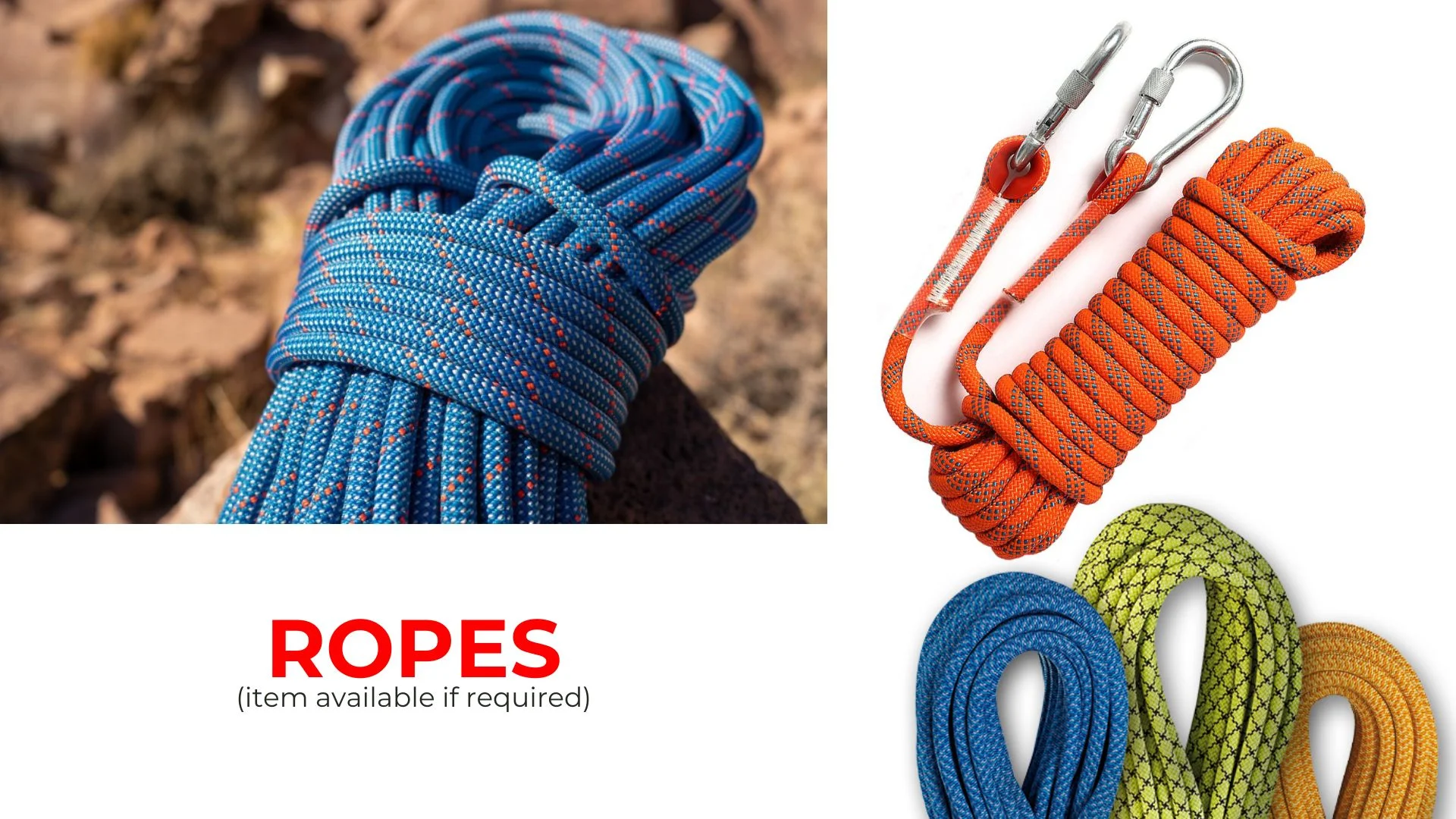
Technical gear: Crampons, ice axe, ropes, harness, helmet, and carabiners.
Other essentials: Trekking poles, sunglasses, sunscreen, first aid kit, and personal hygiene items.
Backpack: Durable backpack for carrying essential gear.
Yes, prior mountaineering experience is strongly recommended. Climbers should be familiar with techniques such as using ice axes, self-arrest, rope climbing, and glacier travel. Many expeditions require climbers to have completed peaks above 6,000 meters or to have completed a Basic Mountaineering Course (BMC).
Yes, the expedition is supported by experienced mountaineering guides and technical staff. The team assists with rope fixing, glacier navigation, safety checks, and route planning to ensure a safe and organized climb.
Yes, climbing Satopanth Peak requires official permits and clearances from government authorities. Trek organizers usually arrange these permits for climbers before the expedition begins.
The full expedition usually takes around 22 days. This includes travel, acclimatization, summit attempts, and the descent back to base.
The expedition involves high-altitude risks such as altitude sickness, extreme weather changes, glacier travel, and technical climbing sections. Proper acclimatization, experienced guides, and safety protocols help reduce these risks.
Trekkers are provided with nutritious meals such as rice, lentils, vegetables, soups, pasta, oatmeal, and fruits. Meals are designed to provide high energy for climbing at high altitude.
Yes, climbers usually receive a certificate after successfully completing the Satopanth Peak Expedition, recognizing their achievement of summiting a high-altitude Himalayan peak.
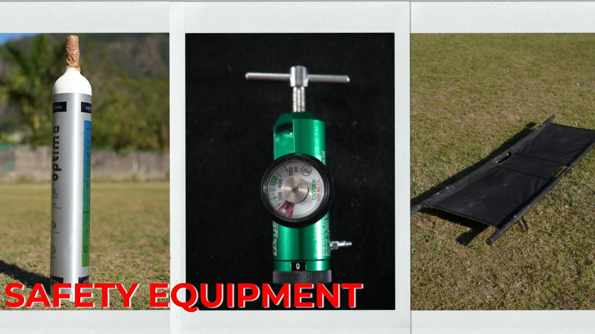
Safety measures include carrying oxygen cylinders, first aid kits, satellite communication devices, and conducting daily health checks. The team also monitors weather conditions and maintains emergency evacuation plans.
Yes, the expedition is safe for women climbers. Separate tents can be arranged when needed, and experienced staff ensure a safe and respectful trekking environment.
No, Satopanth Peak is not suitable for beginners. Climbers should have prior experience with technical expeditions above 6,000 meters and proper mountaineering training before attempting this peak.
Payment & Cancellation Policy:
When you have firmly decided to undertake the Tour with New Knight Adventure, you will need to book the trip with us. We must allocate enough time to prepare, obtain necessary documents and permits, and book hotels and Transport for the trip. 25% advance during the time of booking for confirmation 50% Amount one month prior of arrival in India 25% Amount to be one week prior of arrival in India
Cancellation Policy:
• If the cancellation is made 30 days before the tour starts, 25% of the full payment will be deducted and 75% will be refunded. • If the cancellation is made 20 days before the tour start, 35% of the full payment will be deducted and 65% will be refunded • If the cancellation is made 10 days before the tour start, 80% will be deducted and 20% will be refunded. • No refund is made if the trip is cancelled after the departure for Expedition. • No refund is made during the running tour. • The cost of travel permit or any other documentation charges will not be refundable
Note: New Knight Adventure do all the ground operations in advance (As soon as we received the confirmation request from the guest). We pay advance payment to all our vendors to ensure all the services that we promise with the guest.
HiHello 👋, welcome to NK Adventure (New Knight Adventure)