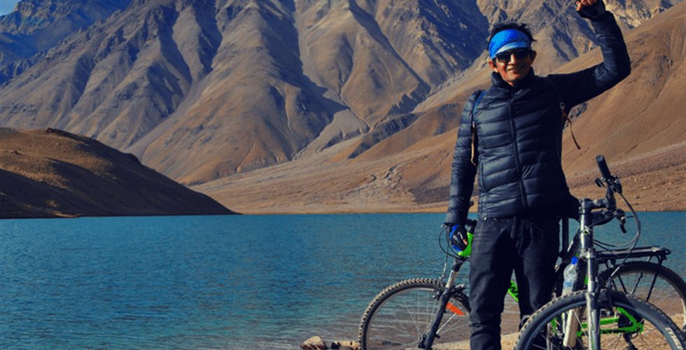
Brief Itinerary
Day 1: Arrival in Manali, Distance: 0, Altitude: 1,980 m (6,400 ft)
Day 2: Manali-Marhi, Distance:38 kms, Altitude: 3,300 m (10,800 ft)
Day 3: Marhi-Chhatru, Distance: 50 kms, Altitude: 3200m (10,499 ft)
Day 4: Chhatru-Batal, Distance: 31 kms, Altitude: 4095m (13,435 ft)
Day 5: Batal-Chandratal, Distance: 14 kms, Altitude: 4300m (14,100 ft)
Day 6: Chandratal-Manali, Distance: 118 kms, Altitude: 3250m (10,663 ft)
Detailed Itinerary
Day 1: Arrival in Manali, Distance: 0, Altitude: 1,980 m (6,400 ft)
Check-in to the booked hotel or orientation camp set up by NK Adventure. Proceedings will start after lunch with a round of introductions for the participants and organizers. The tour leader will brief about the expedition and after that fellow cyclists will be free to explore around Manali. Overnight at the hotel/ camp.
Day 2: Manali-Marhi, Distance:38 kms, Altitude: 3,300 m (10,800 ft)
The first ascent of the trip prepares up for the tough ride ahead and takes you through the panoramic view of pine and deodar trees. We will take an early start to beat the traffic rush destined for Rohtang Pass. One has to negotiate many hairpin bends to reach Marhi. Marhi offers picturesque camping sites and prepares up for the muddy ascent of Rohtang Pass. Overnight in camps.
Day 3: Marhi-Chhatru, Distance: 50 kms, Altitude: 3200m (10,499 ft)
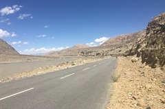
We start the day by finishing the 18km ascent to the Rohtang pass (3980m) and there are some lovely scenic views on the horizon of snow covered peaks and glaciers of Spiti valley. After a refreshing halt at Rohtang, a steady descent takes us to Gramphoo (3250m) on the highway along Chandra river. The day ends with camping at Chhatru. Tucked away hidden in the vast expenses of the rugged Himalayas, a tiny little hamlet Chatru stands out like an oasis in the middle of this “high altitude cold desert” of Spiti in Himachal Pradesh.
Day 4: Chhatru-Batal, Distance: 31 kms, Altitude: 4095m (13,435 ft)
We start early as the road condition from Chhatru to Batal is bad which means more time. Major part of this road is boulder strewn. There are many water crossings where vehicles get struck quite often, but nothing to worry with bicycles. The route goes along the Chandra river.We cross the small village of Chhota Dara (3640m) .After few hours of more paddling we arrive at Batal, where we have the hot lunch in our camps.
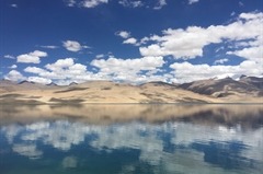
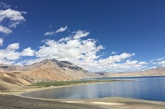
Day 5: Batal-Chandratal, Distance: 14 kms, Altitude: 4300m (14,100 ft)
From Batal diversion up to Chandratal is a gruesome climb. Climb is challenging but the views are equally rewarding. It will take 3-4 hours to arrive at Chandra Tal. The camping is not allowed at the lake but a few Kms before the lake there are good camping sites. We will spend rest of the day soaking in the natural beauty of this jewel in the mountains, Chandratal. Overnight in tents. The most surprising thing about this lake is that there is no visible source of this lake but there is a visible outlet of this lake which means that water to this lake comes from underground.
Day 6: Chandratal-Manali, Distance: 118 kms, Altitude: 3250m (10,663 ft)
The ride back will be in support vehicle . After an uphill ride to Rohtang, we will cruise along the downhill and will reach Manali by evening . The trip ends here & you can book your bus from Manali as per your convenience.